

GIS Applications in Environmental Decision-Making
A Must-Attend Training on GIS Applications
The green and digital transition of the economy, combined with the growing requirements of European policies and funding programs make skills in the management and utilization of geospatial data particularly important for today’s professionals.
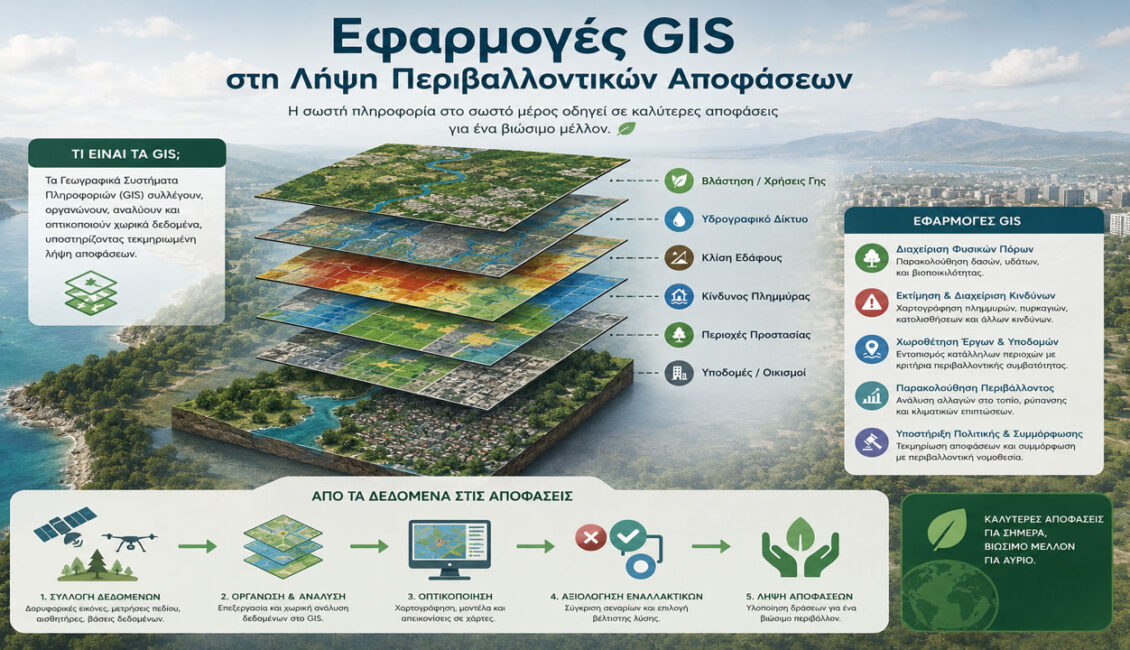
Geographic Information Systems (GIS) are now one of the most powerful tools for analysis and decision-making support in sectors such as the environment, energy, spatial planning, sustainable development, civil protection, and climate resilience. Acquiring practical knowledge and skills in the use of GIS significantly enhances participants’ career prospects and their ability to meet the modern demands of the job market.
This 14-hour training programme provides practical, application-oriented training in the use of GIS for environmental analysis, mapping, environmental impact assessment and evidence-based decision-making.
What the Training Covers
- Fundamentals of Geographic Information Systems (GIS)
- Geospatial Data Sources, Management and Visualisation
- Spatial Analysis for Environmental Decision-Making
- Use of GIS in Sustainable Development and Environmental Planning
- Working with Real-World Data Sources
- Practical Applications using case studies like Renewable Energy, Natural Resource Management and Climate Resilience
Who Should Attend
The programme is aimed at professionals and executives working in fields such as the environment, energy, spatial planning and technical studies, as well as individuals involved in projects, studies or decision-making processes with environmental or spatial dimensions.
- Engineers, environmental professionals, urban planners, architects and other public or private sector professionals involved in projects, studies or policies related to the environment, energy and sustainable development.
- Professionals from consulting, technical, research, planning or design organisations who wish to strengthen their ability to use GIS for data analysis, environmental assessment and decision-making.
Prior experience with GIS is not required. However, participants should have basic computer skills and an interest in environmental analysis, spatial data and sustainable planning.
Ermis HRDA Code 724032
Dates: 29-30 June 2026
Seminar cost €380 | HRDA subsidy €280 | Net cost €100
The seminar is approved by Human Resource Development Authority of Cyprus (HRDA)